![](/images/other/stat-length.png)
![Excursión Senderismo Le Palais - Le Palais- Locmaria - Photo](https://media.geolcdn.com/t/1900/400/975f3097-a92d-47a5-80dc-269a17a9d93f.jpg&format=pjpeg&maxdim=2)
Le Palais- Locmaria
DuMarsan
Usuario
![Longitud](/images/other/stat-length.png)
Longitud
17,6 km
![Altitud máxima](https://static1.geolcdn.com/siteimages/upload/files/1508320355ic_sort_altitude_max_24dp.png)
Altitud máxima
51 m
![Desnivel positivo](https://static1.geolcdn.com/siteimages/upload/files/1508320355ic_sort_den_pos_24dp.png)
Desnivel positivo
390 m
![Km-Effort](/images/other/stat-length.png)
Km-Effort
23 km
![Altitud mínima](https://static1.geolcdn.com/siteimages/upload/files/1508320355ic_sort_altitude_min_24dp.png)
Altitud mínima
0 m
![Desnivel negativo](https://static1.geolcdn.com/siteimages/upload/files/1508320355ic_sort_den_neg_24dp.png)
Desnivel negativo
357 m
![Boucle](https://static1.geolcdn.com/siteimages/upload/files/16400158638029165_repeat_loop_refresh_sync_direction_icon.png)
Boucle
No
Fecha de creación :
2021-08-19 07:08:42.782
Última modificación :
2021-08-19 13:50:19.781
![Senderismo](https://static1.geolcdn.com/sitytour/trail-icons/101.png)
6h40
Dificultad : Medio
![Escanee este código QR para abrir la excursión en la aplicación SityTrail](https://capi.geolives.com/qq0zvz2zws4bq2lad0pu/sitytour/trails/2904632/qr.png?size=200)
Aplicación GPS de excursión GRATIS
A propósito
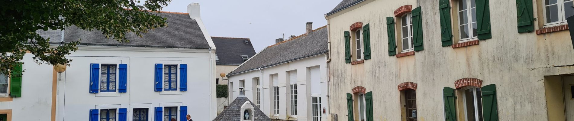
Ruta Senderismo de 17,6 km a descubrir en Bretaña, Morbihan, Le Palais. Esta ruta ha sido propuesta por DuMarsan.
Descripción
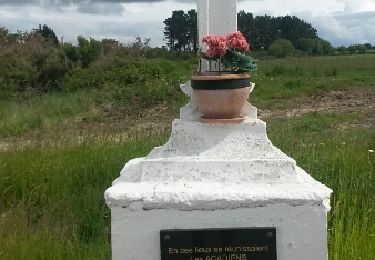
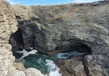
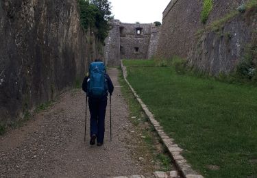
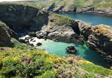
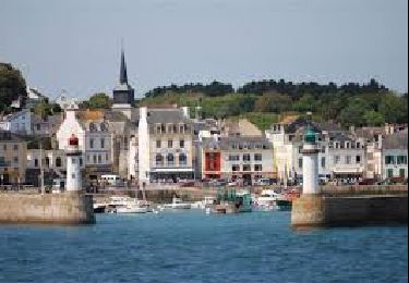
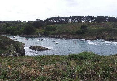
portion la plus bucolique, la plus abritée et la moins sauvage de l ile. Mais quand les genoux sont bien fatigués de cet enchaînement de randonnées, c est bien agréable pour boucler le tour de l ile.
Localización
País:
France
Región :
Bretaña
Departamento/provincia :
Morbihan
Municipio :
Le Palais
Localidad:
Unknown
Salida:(Dec)
Salida:(UTM)
488397 ; 5243663 (30T) N.
Comentarios
Excursiones cerca
![Excursión Senderismo Bangor - bangor - Photo](https://media.geolcdn.com/t/375/260/ext.jpg?maxdim=2&url=https%3A%2F%2Fservices.sitytrail.com%2FGeolivesWS%2FDownloadMedia.ashx%3FTrailID%3D308558%26Media%3Dfix__20140530104824.jpg)
![Senderismo Senderismo](https://static1.geolcdn.com/sitytour/trail-icons/101.png)
bangor
Senderismo
Muy fácil
(1)
Bangor,
Bretaña,
Morbihan,
France
![](/images/other/stat-length.png)
9,4 km | 11,2 km-effort
2h 40min
![](https://static1.geolcdn.com/siteimages/upload/files/16400158638029165_repeat_loop_refresh_sync_direction_icon.png)
Sí
![Excursión Senderismo Le Palais - J4 - Le Palais - Locmaria - 18 km - Photo](https://media.geolcdn.com/t/375/260/ext.jpg?maxdim=2&url=https%3A%2F%2Fstatic1.geolcdn.com%2Fsiteimages%2Fupload%2Ffiles%2F1553511878bg_sport_marche.png)
![Senderismo Senderismo](https://static1.geolcdn.com/sitytour/trail-icons/101.png)
J4 - Le Palais - Locmaria - 18 km
Senderismo
Muy difícil
(1)
Le Palais,
Bretaña,
Morbihan,
France
![](/images/other/stat-length.png)
18,2 km | 23 km-effort
5h 14min
![](https://static1.geolcdn.com/siteimages/upload/files/16400158638029165_repeat_loop_refresh_sync_direction_icon.png)
No
![Excursión Senderismo Le Palais - J1 - Le Palais - Pointe des Poulains - 18,5 km - Photo](https://media.geolcdn.com/t/375/260/ext.jpg?maxdim=2&url=https%3A%2F%2Fstatic1.geolcdn.com%2Fsiteimages%2Fupload%2Ffiles%2F1553511878bg_sport_marche.png)
![Senderismo Senderismo](https://static1.geolcdn.com/sitytour/trail-icons/101.png)
J1 - Le Palais - Pointe des Poulains - 18,5 km
Senderismo
Muy difícil
(1)
Le Palais,
Bretaña,
Morbihan,
France
![](/images/other/stat-length.png)
18,4 km | 23 km-effort
5h 18min
![](https://static1.geolcdn.com/siteimages/upload/files/16400158638029165_repeat_loop_refresh_sync_direction_icon.png)
No
![Excursión Senderismo Le Palais - 1-Le Palais-l'Apothicairerie à Belle Île - Photo](https://media.geolcdn.com/t/375/260/4a7c2c9a-728e-41b2-9fc8-682a137d6991.jpg&format=jpg&maxdim=2)
![Senderismo Senderismo](https://static1.geolcdn.com/sitytour/trail-icons/101.png)
1-Le Palais-l'Apothicairerie à Belle Île
Senderismo
Medio
Le Palais,
Bretaña,
Morbihan,
France
![](/images/other/stat-length.png)
25 km | 31 km-effort
5h 0min
![](https://static1.geolcdn.com/siteimages/upload/files/16400158638029165_repeat_loop_refresh_sync_direction_icon.png)
No
![Excursión Senderismo Le Palais - GR340 - BELLE ILE - Jour 1 : Le Palais - Pointe des Poulains - Photo](https://media.geolcdn.com/t/375/260/2d621faf-5a5b-47f8-85dc-eea8376dad65.jpg&format=jpg&maxdim=2)
![Senderismo Senderismo](https://static1.geolcdn.com/sitytour/trail-icons/101.png)
GR340 - BELLE ILE - Jour 1 : Le Palais - Pointe des Poulains
Senderismo
Difícil
Le Palais,
Bretaña,
Morbihan,
France
![](/images/other/stat-length.png)
19,4 km | 24 km-effort
4h 23min
![](https://static1.geolcdn.com/siteimages/upload/files/16400158638029165_repeat_loop_refresh_sync_direction_icon.png)
No
![Excursión Senderismo Le Palais - Tour de Belle-Ile - Photo](https://media.geolcdn.com/t/375/260/ext.jpg?maxdim=2&url=https%3A%2F%2Fservices.sitytrail.com%2FGeolivesWS%2FDownloadMedia.ashx%3FTrailID%3D1116186%26Media%3D2cacb688-3133-4b90-93e5-ba8ee68211bf.jpg)
![Senderismo Senderismo](https://static1.geolcdn.com/sitytour/trail-icons/101.png)
Tour de Belle-Ile
Senderismo
Muy difícil
Le Palais,
Bretaña,
Morbihan,
France
![](/images/other/stat-length.png)
79 km | 100 km-effort
21h 36min
![](https://static1.geolcdn.com/siteimages/upload/files/16400158638029165_repeat_loop_refresh_sync_direction_icon.png)
Sí
![Excursión Senderismo Sauzon - Belle-Ile la pointe des poulains - Photo](https://media.geolcdn.com/t/375/260/8bb296b7-1fea-441d-8b74-80731f369ead.jpg&format=jpg&maxdim=2)
![Senderismo Senderismo](https://static1.geolcdn.com/sitytour/trail-icons/101.png)
Belle-Ile la pointe des poulains
Senderismo
Fácil
Sauzon,
Bretaña,
Morbihan,
France
![](/images/other/stat-length.png)
16 km | 19,5 km-effort
6h 28min
![](https://static1.geolcdn.com/siteimages/upload/files/16400158638029165_repeat_loop_refresh_sync_direction_icon.png)
Sí
![Excursión Senderismo Le Palais - Tour de Belle-Ile - étape 1 : Le Palais - les Poulains - Photo](https://media.geolcdn.com/t/375/260/7946a798-8986-4217-ba63-5d3483bf84ad.png&format=jpg&maxdim=2)
![Senderismo Senderismo](https://static1.geolcdn.com/sitytour/trail-icons/101.png)
Tour de Belle-Ile - étape 1 : Le Palais - les Poulains
Senderismo
Fácil
Le Palais,
Bretaña,
Morbihan,
France
![](/images/other/stat-length.png)
19,4 km | 24 km-effort
5h 18min
![](https://static1.geolcdn.com/siteimages/upload/files/16400158638029165_repeat_loop_refresh_sync_direction_icon.png)
No
![Excursión Senderismo Le Palais - Le Palais-Sauzon - Photo](https://media.geolcdn.com/t/375/260/ext.jpg?maxdim=2&url=https%3A%2F%2Fservices.sitytrail.com%2FGeolivesWS%2FDownloadMedia.ashx%3FTrailID%3D333502%26Media%3D0844a11d-6f36-44c8-9358-122cf9dff1ae.jpg)
![Senderismo Senderismo](https://static1.geolcdn.com/sitytour/trail-icons/101.png)
Le Palais-Sauzon
Senderismo
Medio
Le Palais,
Bretaña,
Morbihan,
France
![](/images/other/stat-length.png)
13,3 km | 16,9 km-effort
4h 0min
![](https://static1.geolcdn.com/siteimages/upload/files/16400158638029165_repeat_loop_refresh_sync_direction_icon.png)
No